Archaeology and heritage
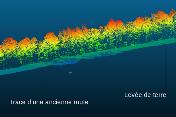
Archaeological prospecting
In archaeological prospecting missions, vegetation cover can slow field research or research based on aerial imagery. In these cases, the sub-vegetation micro-topography produced by lidar is an invaluable aid to revealing anomalies that may correspond to archaeological features (walls, banks, ditches, etc.). This technique provides a new perspective on forested regions and a means of mapping remains over extensive areas.
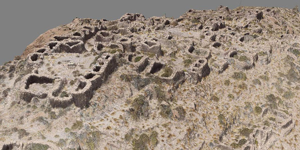
Mapping for archaeological and anthropological research
For historical or environmental purposes, L’Avion Jaune produces maps at the interface of archaeology and environmental research, both in France and abroad. For example, as part of an anthropological and agronomic project L’Avion Jaune conducted an aerial mapping mission using a fixed-wing drone on the slopes of the Tunupa Volcano as part of a study on pre-Inca quinoa farming systems.
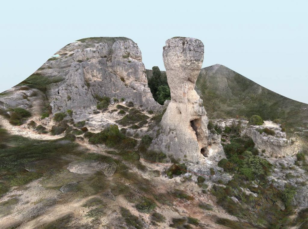
Promoting heritage
Safeguarding and promoting the natural and cultural heritage is an issue of major importance in numerous regions. 3D modelling by aerial photogrammetry or airborne lidar offer the possibility of studying and promoting heritage sites. The models can be used for the conservation and restoration of sites, or to develop them and make them more easily accessible to the public. The realism of these virtual models also makes them excellent educational and communication materials.