Ecology
Habitat mapping
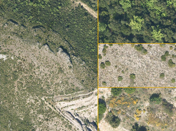
Orthophotos provide precise and up-to-date images of the extent and nature of natural habitats and adjacent anthropic activities. Photo-interpretation by an expert ecologist of a visible-band, high-resolution image can help provide an initial map of natural habitats. This image can also be used to prepare and interpolate the naturalist’s inventory.
The use of additional spectral bands, such as near-infrared, can contribute new input for the mapping of certain environments, especially wet zones. Multispectral orthophotos can also be segmented and classed by algorithms for semi-automated, radiometry-based mapping.
Detection of protected or invasive species
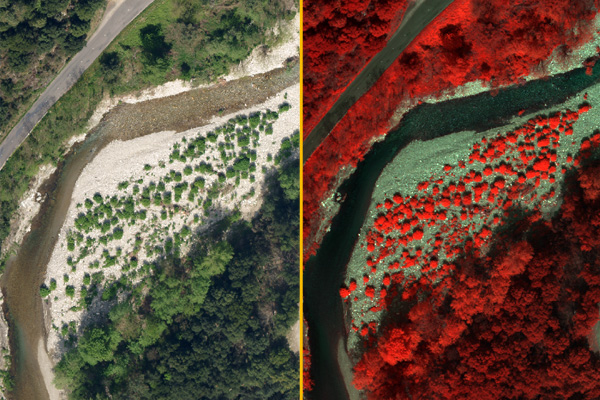
Analysis of a visible-band or multispectral orthophoto can help identify particular species of plant. Detection can, in certain cases, be automated, allowing rapid mapping of the distribution of the respective species. This kind of mapping is a sound support tool for deciding which are the most appropriate management measures to take.
Study of the functioning of natural environments and ecological engineering
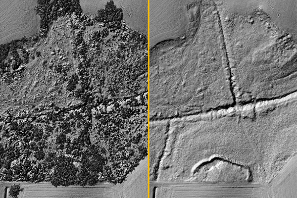
Lidar imaging is a way of mapping topography and obtaining a digital terrain model, including beneath vegetation. Using this model can help us to understand how ecosystems work by analysing the hydrology or the altitude at which species develop. This technique is especially relevant for the study of forested wetlands such as riverbanks, peat bogs and mangroves.
An understanding of these mechanisms can also serve as a basis for restoring ecosystems by means of ecological engineering.
Since 2015, L’Avion Jaune has been a member of the Professional Ecological Engineering Union (UPGE) with the aim of making remote sensing techniques known to as wide a public as possible and putting them at the service of industry professionals.