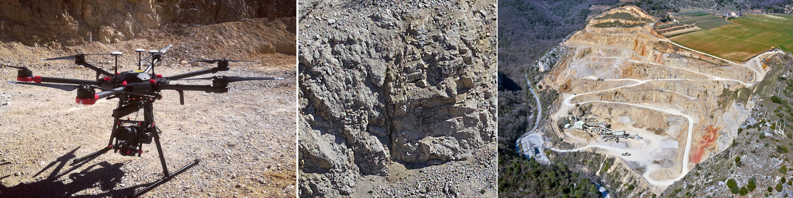
Together with its partner Positics, L’Avion Jaune has built a Phase One iXU 1000 sensor into its M600 drone to produce very high-resolution 3D models of quarries.
This photogrammetric data will enable the geological and mining research agency BRGM to study the network of fractures in analogues of potential geothermal reservoirs.
The quarry model will enable us to reconstitute the network beyond levels accessible by foot, as well as to obtain quantitative information about the rock (dimensions, orientation, density).