Energy and infrastructure
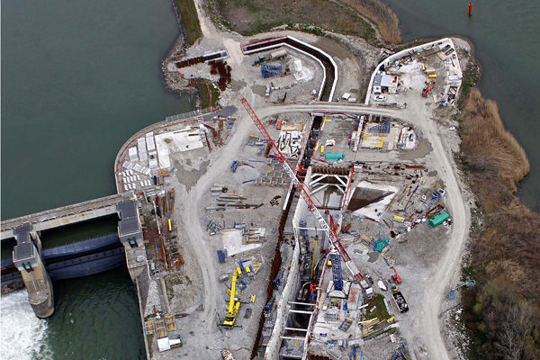
Industrial sites
Combining 3D digital models with high-resolution images allows site managers to save time on construction projects, make operations safe by avoiding dangerous human intervention and monitor construction progress, as well as to improve communications about a project.
L’Avion Jaune creates orthophoto maps, DSMs, textured 3D meshes, and 3D models for all types of structure or infrastructure, such as:
- Industrial sites
- Mines and quarries
- Dikes
- Structures: bridges, dams, etc.
- Construction projects: roads, railway stations, etc.
- Heritage sites: churches, historic buildings

Thermography
For the specific needs of our customers in the energy sector, L’Avion Jaune produces aerial thermography data at or near industrial and nuclear sites to detect technical failures or measure the impact of the facilities on their immediate environment.
This remote, non-destructive technique helps keep production processes safe and reliable by enabling maintenance operations to be planned and improved – without halting production.
L’Avion Jaune’s flexibility and swift response times enable it to intervene rapidly in coordination with field teams when the best conditions for measuring occur (flow rates, temperature, production).
This technique is of relevance for:
- Hydro-electric sites
- Solar farms
- Industrial infrastructures
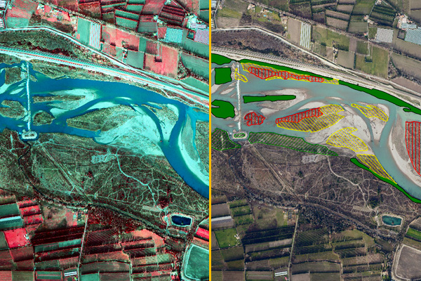
Fire agriculture and water course management
For impact studies or planning grubbing works near to hydroelectric installations, L’Avion Jaune supplies orthophotos, 3D models or habitat classifications as a decision support tool for the site operators.
With its lightweight aerial resources, L’Avion Jaune has acquired experience in mapping rivers along stretches of several hundred kilometres, following the morphology of the water course.