LIDAR
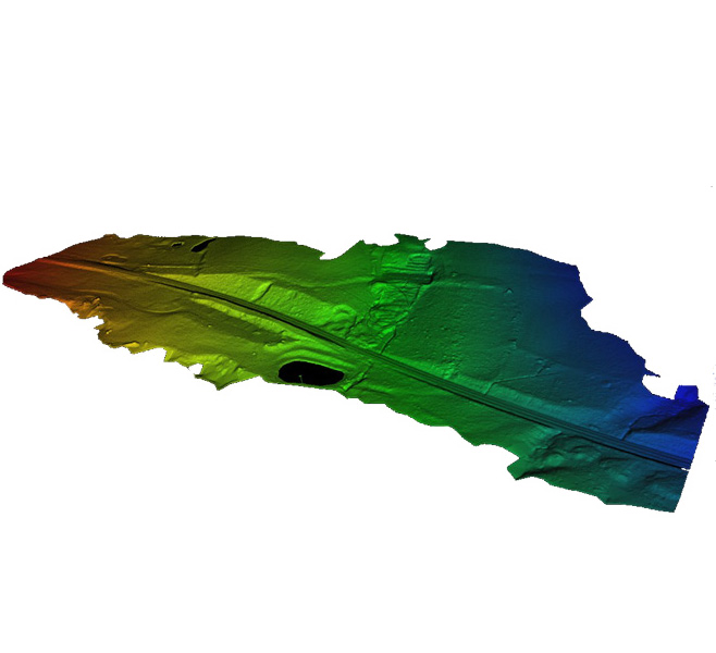
Lidar is, like photogrammetry, a method of mapping topography and producing 3D models such as digital surface models (DSMs), digital terrain models (DTMs), a point cloud or a textured 3D mesh. The two approaches are complementary and suitable for different uses.
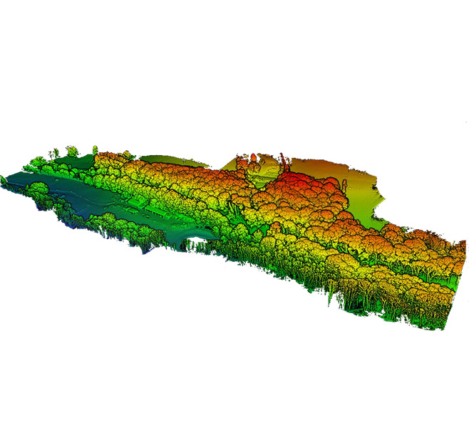
The crucial advantage of this technology is that it allows the topography to be mapped even beneath vegetation. The emitted rays are able to pass through gaps in the canopy to reach objects and the ground.
Precise 3D modeling
Lidar (LIght Detection and Ranging) is an active remote sensing technology based on a laser scanner. The scanner emits a light beam towards the ground and the reflected ray is captured and analysed. The return time enables the distance of the object from the sensor to be calculated and, combined with the recording of the scanner’s path, this information makes it possible to locate the point precisely in space. This procedure is repeated millions of times over, allowing the terrain to modelized in 3D by a point cloud.
L’Avion Jaune has special expertise in the use of drone lidar technology for mapping topography. In 2013, as part of its R&D work, our team developed the first lidar sensor for drones. Although these instruments are now marketed by our sister company and partly-owned subsidiary YellowScan, the two companies work together and L’Avion Jaune takes advantage of the latest technical improvements to offer you 3D models of the highest quality.
Multiple applications
Topography
Le LIDAR est l'outil topographique par excellence pour tout projet d’aménagement du territoire. La technologie permet une modélisation précise tant de la végétation, du sur-sol, que du terrain naturel.
Environment
En cartographiant sous la végétation, le LIDAR permet un suivi des zones à l'écosystème fragile : lits de rivières, zones humides ou boisées, et ainsi de répondre aux problématiques de gestion des zones inondables ou de restauration écologique par exemple.
Infrastructure
Traiter efficacement un nuage de point issu de LIDAR aéroporté permet d'établir avec précision des surfaces, des volumes de stockage ou l'évolution au fil du temps d'une infrastructure maritime ou difficile d’accès.