Forestry
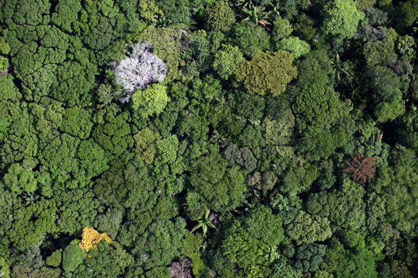
Stand mapping and identification of species of interest
Visible-band orthophotography provides precise, up-to-date images of the extent and type of forest cover. These images can serve to prepare or complement field work and to extend it to areas difficult to access by foot.
Besides producing vegetation indices (NDVI, LAI), access to additional spectral bands can help in the characterization of stands or detection of tree species and the study of tree health.
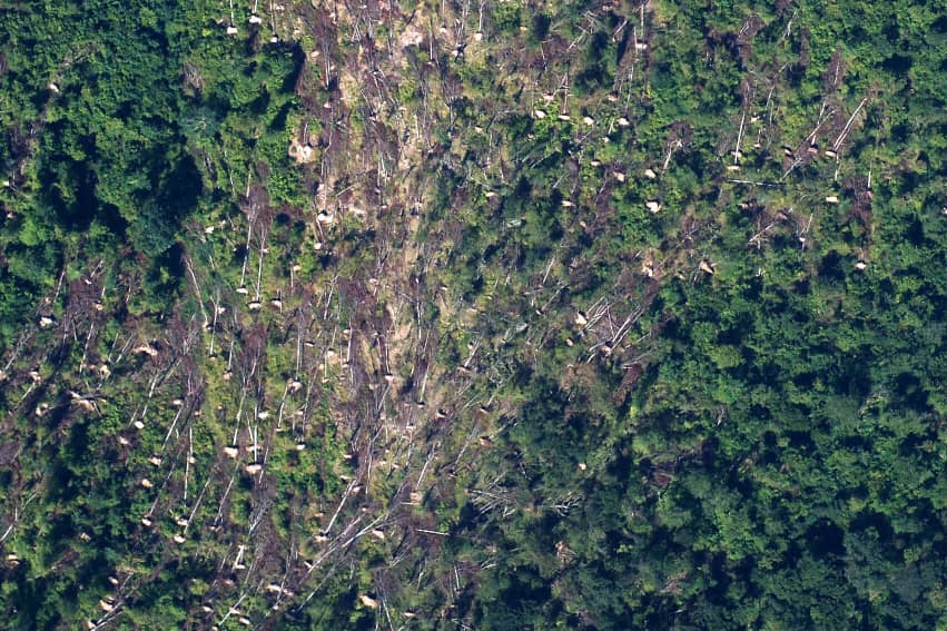
Damage mapping
In certain cases, aerial photography may be necessary to localise or quantify damage by natural phenomena or parasites. Overhead viewing enables a rapid and exhaustive assessment of the extent of the damage in environments which may be difficult to cover by foot. Maps of the affected areas also help guide experts for complementary analysis in the field.
Damage mapping is useful after events such as:
- Storms, cyclones
- Flooding
- Parasite attacks
- Meteorological crop damage (frost, hail, drought, etc.)
- Damage by wild animals (e.g. wild boar
For example, L’Avion Jaune conducted flights over the Landes forest after Storm Klaus in 2009.
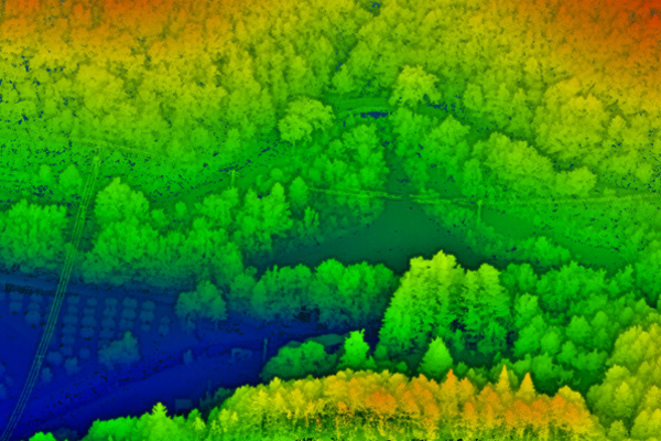
Canopy modelling, biomass estimate and growth monitoring
With lidar imaging, we can build a digital terrain model (DTM) of the ground beneath the forest cover and draw up a canopy height model showing the height of the trees. These models can then be used in forestry for operational planning (forward planning of exploited areas, skidding trails) or management measures. In certain cases, the data can also be used to specifically measure the heights and diameter of individual trees, or estimate volumes of wood per hectare. Successive image acquisitions can be conducted to monitor tree growth.